GeoTech Center Team
Director and Principal Investigator

|
Vincent A. DiNoto Jr. is Dean of College and Systemic Initiatives and Professor of Physics, Astronomy, and Geosciences at Jefferson Community and Technical College located in Louisville, KY. He is Director and Principal Investigator of the National Geospatial Center of Excellence a National Science Foundation Center, located at Jefferson Community and Technical College. He received his M.A. and B.S. from Indiana State University and has been on the faculty at Indiana State University and Indiana University Southeast before coming to Jefferson. He is former co-PI of National Supply Chain Technology Education Center and the National Information and Computer Center and was director and co-PI of Kentucky Information Technology Center. He has served as PI, or co-PI on numerous NSF projects. He developed one of the first Astronomy Laboratories at a community college in the country. His current research interest includes education technologies, contextual learning, integrated courses, mapping of historic Civil War Battlefields and Water Powered Industries. He has authored numerous courses and offered them in an online delivery mode. He has written and presented numerous professional article his most recent published work is on the Two Great Armories.
Contact: 502-213-7280, [email protected] |
Associate Directors and Co-Principle Investigators

|
Nicole Ernst holds Bachelor of Arts degrees in political science (Slippery Rock University) and environmental studies (Montana State University) and a Master of Arts degree in Geography from East Carolina University. In her professional career, she has worked as a cartographer for the National Park Service at Bighorn Canyon in Montana/Wyoming and then for the Outer Banks Group of parks in North Carolina. Currently, she is Associate Professor of Geospatial Technology at Harrisburg Area Community College (HACC) in Central Pennsylvania. At HACC she teaches for the college’s Virtual Learning unit and uses community based geospatial projects to enhance the student experience. In addition to her teaching duties, Nicole has serves as co-chair for the Central Pennsylvania GIS Day event which is a partnership event between HACC and the Commonwealth of Pennsylvania, Esri, PASDA, and the Nature Conservancy.
Nicole was the recipient of the 2014 Distinguished Geospatial Educator Award from the Geotech Center and was also the 2017 recipient of the Pennsylvania Mapping and Geospatial Information Consortium (PAMAGIC) Excellence Award. Nicole serves as a steering committee member for the Pennsylvania Alliance for Geographic Education, and she is a member of the Pennsylvania GIS Conference Planning Committee, PAMAGIC, and the Pennsylvania Geographical Society. Contact: [email protected] |

|
Ann Johnson holds a Bachelor and Master of Science degree in Geology. While teaching Earth Sciences, she became interested in how Geographic Information Systems can be used as a tool in geology and education. After attending an NSF funded workshop to help college faculty learn GIS, she developed a GIS Certificate Program at San Bernardino Valley College. In 1997 she joined ESRI as Higher Education Manager helping colleges and universities develop GIS programs. She has been Co-PI on several NSF Grants related to GIS and two-year colleges and is a co-editor for the UCGIS Body of Knowledge and a lead on the development of the Geospatial Technology Competency Model curriculum outlines for Model Courses. Currently, she is Associate Director of the GeoTech Center NSF grant to support community college geospatial programs and Co-PI on the iGETT NSF grant to provide faculty education in remote sensing. She lives in Salmon, Idaho with husband, Robert, a dog, Siv and four chickens – a great place for fishing, geology, and GIS.
Contact: [email protected] or [email protected] |

|
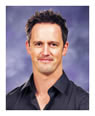
Rich Schultz is an Associate Dean of Online Learning at North Park University in Chicago, Illinois. Rich holds a PhD. in environmental geochemistry from the University of Cincinnati, an M.S. in geology from Wichita State University and a B.S. in geology from Illinois State University. Dr. Schultz is the sole or senior author of more than ninety publications, book chapters, presentations, and abstracts. His major areas of research are geospatial technologies, unmanned aerial systems (UASs), geoscience education, online/distance learning, geospatial thinking, global climate change, the scholarship of teaching and learning, and the use of technology in teaching geography literacy. He has previously chaired the Geography Education Specialty Group for the Association of American Geographers (AAG) and has served on the AAG Membership Committee as well as chairing the National Council for Geographic Education’s Awards Committee and serving on the NCGE Nominating Committee as well as the Vice President for Products & Publications for the NCGE Administrative Committee. Rich recently served on the AAG AP GIS&T Proposal Committee and currently is a member of the Certification Governance Board (CGB) for the National Geospatial Intelligence Foundation (NGIF).
Dr. Schultz was the recipient of the 2008 Distinguished Teaching Award from the National Council for Geographic Education (NCGE) and also received the “GIS Service Award” for geospatial education service to the Illinois GIS Association (ILGISA) in October 2009. He was the inaugural recipient of the Richard Hilton Collaboration Award for the GIS Community in Illinois from ILGISA in 2010. He serves on the Editorial Boards for the Journal of Geography for the National Council for Geographic Education (NCGE), Editorial Board, the Review of International Geographical Education Online (RIGEO), and the Research in Geographic Education at the Gilbert M. Grovenor Center for Geographic Education. Contact: [email protected] |

|
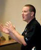
Ken Yanow is a Professor of Geographical Sciences, has been at Southwestern College for the past 12 years, where he teaches Physical Geography, Earth Science, GIScience, and Remote Sensing. He received his Bachelorette degree from UC Santa Barbara in Physics and two Master degrees (Astronomy and Geography) from San Diego State University. Professor Yanow is co-PI for the NSF-funded National Geospatial Technology Center of Excellence (the GeoTech Center), where his primary research focus has been the recruitment and retention of underserved and underrepresented populations into geospatial technology courses and programs.
Contact: 619-300-5954, [email protected] |

|
Wing Cheung is a Professor of Geography, Geographic Information Science, and Drone Technology at Palomar College. He is also the Coordinator of the GIS and Drone Technology Certificate and Associate’s Degree programs at the College. Professor Cheung has experience in environmental science (groundwater and surface water hydrology), GIS, grant writing, project management, program development, and research. He received his Doctoral Degree in Policy, Planning, and Design from the University of California-Irvine, and completed his Master Degrees in Public Affairs and Environmental Science from Indiana University-Bloomington. Professor Cheung is also the Principal Investigator of an Advanced Technological Education project grant from the National Science Foundation (DUE # 1700552-Unmanned Aircraft System operations Technician Education Program).
Contact: 760-744-1150 ext. 3652, [email protected] |
|
Adam Dastrup is the Coordinator of the Geosciences Department and an Associate Professor at Salt Lake Community College (SLCC). While there he has taught a variety of physical and cultural geography, earth and environmental science, and geospatial technology courses. He is also the founder of Open Geography Education, an open education resource (OER) for educators. At SLCC, Adam is a faculty leader in high impact practices, online learning, and educational pathways for students. Finally, Adam is heavily involved in advancing the scholarship of teaching and learning, and application of geospatial technology in community college settings.
Contact: 801-957-4880, [email protected] |

|
Rodney Jackson received his degree in Geography from East Carolina University (ECU) in 1992 and worked in the GIS field for local government agencies before initiating a career in higher education in 1998. He began his efforts by developing the first Geographic Information Systems program in the North Carolina Community College System. Subsequently, Rodney has held various academic positions with East Carolina University, Central Piedmont Community College, and Edgecombe Community College, implementing Geospatial Technology initiatives along the way. Also, he is a Co-Principal Investigator of the National Geospatial Technology Center, serves on the GISCI Examination Oversight Committee, and is a member of the UCGIS Body of Knowledge Task Force Steering Committee. Rodney is currently the Dean for the School of Business, Engineering & Technical Studies at Davidson County Community College, and in his free time is an Engineer Officer (Geospatial Identifier) in the US Army Reserves.
Contact: [email protected] |

|
Scott Jeffrey is a Professor and the Program Director for the Geospatial Applications Program at the Community College of Baltimore County in Catonsville, Maryland. A 1981 graduate of the University of Maryland, Baltimore County (B.S. in Geography) he received an M.S. in Geography and Anthropology from Louisiana State University (1985) and a post-baccalaureate certification from the University of Maryland, Baltimore County in Instructional Systems Design. Professor Jeffrey was awarded the 2008-2009 Maryland Professor of the Year by the Carnegie Foundation and the Council for the Advancement and Support of Education (CASE). In 2009, under his tenure as Director the Geospatial Applications Program, he was recognized by the Maryland State Department of Education as the Outstanding Career and Technology Education Program (Postsecondary).
Contact: [email protected] |

|
John Johnson (consultant) has Degrees in Geography, Urban & Regional Planning, and Business Administration. He also has a Teaching Credential and is certified as an ESRI and Trimble Authorized Instructor. Mr. Johnson has helped to develop two Community College GIS programs and has served as a GIS curriculum consultant on some projects.
Contact: 760-889-8606, [email protected] |

|
Candiya Mann serves as the GeoTech Center's external evaluator. She is a Senior Research Associate at the Social and Economic Sciences Research Center of Washington State University. She has served as an external evaluator of numerous NSF Centers and projects and a presenter for the EvaluATE Center at Western Michigan University.
Contact: [email protected] |
|
Dr. Thomas R. Mueller has taught at California University of Pennsylvania for over 14 years. He has taught a wide variety of courses including World Regional Geography, GIS, crime mapping, demographic analysis, and spatial models in public safety. His research agenda has grown dramatically throughout his career at California University of Pennsylvania. He applies spatial theory to the real world using Geographic Information Systems. His key to building a successful research agenda is to produce work through a variety of scholarly endeavors, including conference presentations, grants, technical reports, book reviews and publications in professional journals. He also has taught numerous GIS workshops for members of the local community, professors at Cal U and other campuses, and for the K-12 community.
Contact: [email protected] |

|
Ming-Hsiang (Ming) Tsou (senior researcher) is a Professor in the Department of Geography, San Diego State University. His research interests are in Internet mapping and distributed GIS applications, mobile GIS and wireless communication, multimedia cartography and user interface design, and software agents with GRID computing technology. He serves as the major university advisor to the GeoTech Center on matters of articulation and recruitment of minority students.
Contact: [email protected] |

|

|
Lachel Lodge, Assistant to the Director, (502) 213-7356, [email protected]
Ms. Lodge is responsible for all information concerning the National GeoTech Center operation, including events and financial reporting. Typical Office Hours are 9 AM to 5:30 AM Eastern. |
|
Chris Wright, Geospatial Technician and Remote Pilot, (502) 213-7269, [email protected]
|
Center's Team

|

|
|
|

|

|

|

|

|

|
